This map shows sites in Queensland that have had fire ants in the last 12 months.
Use the fire ant map to view a snapshot of recent fire ant detections in Queensland. You can browse the interactive map below to see fire ant sites near you.
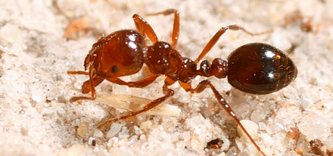
Map data is collected using ‘suspect ant reports’ submitted by members of the public, and fire ant nests identified by our program officers. This map only shows confirmed infested sites where our staff have verified the suspect ant as a fire ant.
Once a fire ant nest is confirmed a treatment strategy is implemented depending on factors such as public safety, time of year and location. We prioritise the treatment of sites where there may be an increased risk to human health, including parks, schools, and sports grounds.
The data in this map is updated daily.
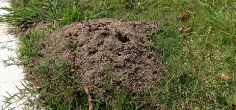
All confirmed fire ant infested site locations will appear on this map for 12 months, regardless of whether treatment has taken place. Each infested site location may contain one or more fire ant nests.
To maintain privacy, this map does not display individual addresses. It displays the general area of sites that have had fire ants.
View the interactive and printable fire ant biosecurity zones map here.