This project is mapping the condition of grazing land in the Burdekin, Fitzroy and Burnett Mary NRM regions. By looking at the condition of land used for grazing, we can better:
- understand and evaluate its carrying capacities and potential for sediment loss
- prioritise and evaluate on-ground investments in land improvements.
Until recently, land condition has proven difficult to map. This project addresses the challenge of mapping land condition by using leading-edge technology to generate broadscale land-condition mapping and distributes it to stakeholders in the Great Barrier Reef catchments for better production and sustainability.
What we do
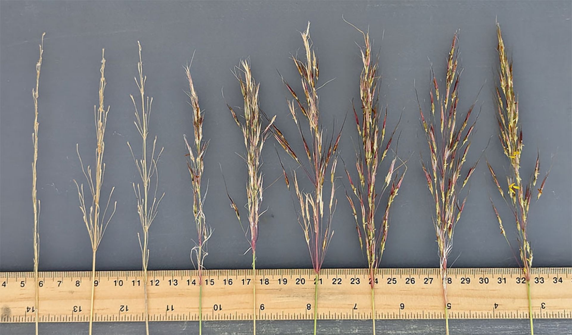
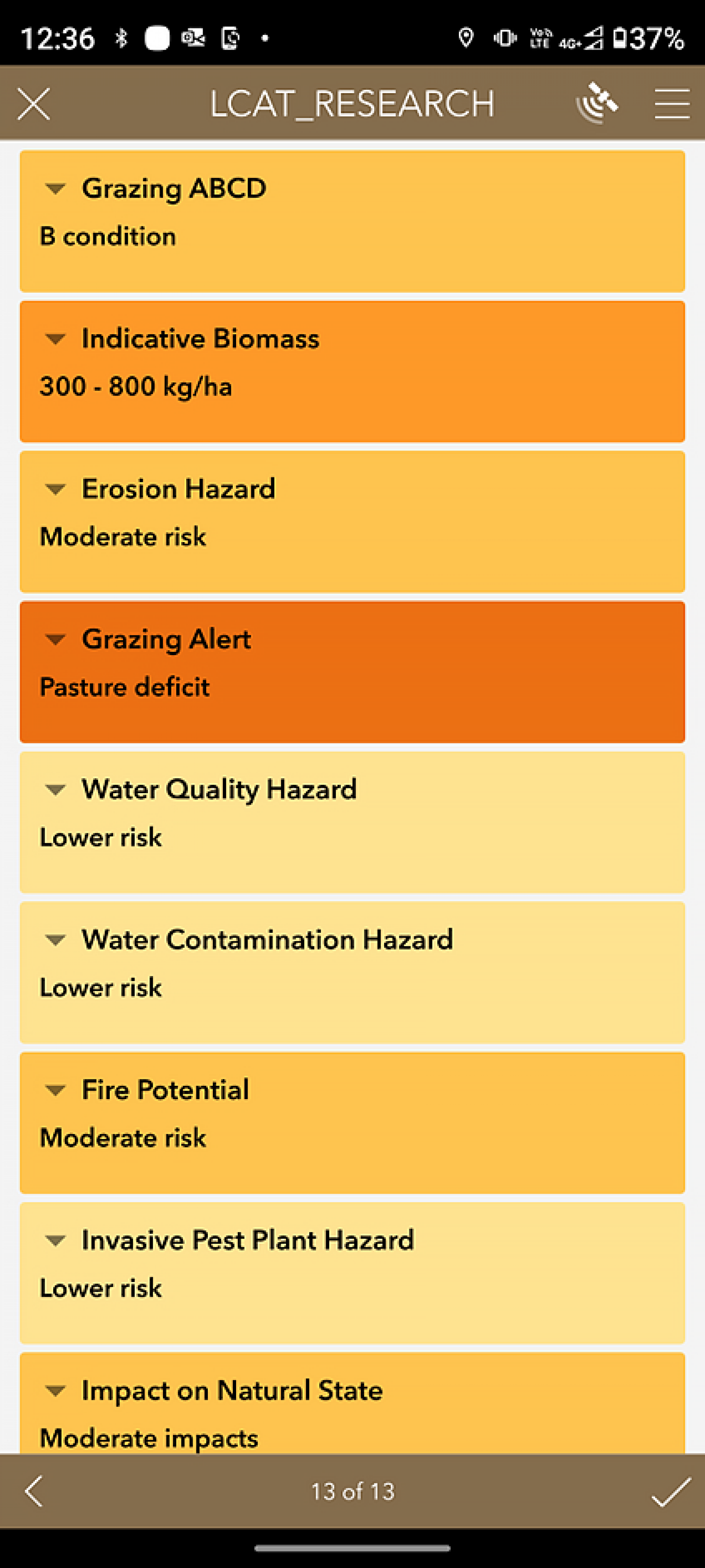
We’re collecting more than 2,000 land condition assessments across the Fitzroy, Burnett Mary and Burdekin NRM regions using the newly developed Land Condition Assessment Tool (LCAT) app. These assessments will train a neural network machine learning model that will annually map grazing land condition across the catchments.
In addition, the project will:
- upgrade the VegMachine.net website
- develop a digital pasture plant identification tool to support Queensland LCAT users
- evaluate the progressive iterations of the land condition mapping through:
- statistical analysis
- field testing
- hands-on review by experienced graziers and field staff.
The project has accumulated more than 700 LCAT assessments and produced a first iteration of land condition mapping in 2022/23.
We will produce updated land condition maps of the target regions on an annual basis.
Find out more
- Contact DAF’s customer service centre.
- Visit Queensland Agriculture’s YouTube channel and search for ‘better beef production’.
Last updated: 04 Aug 2023